
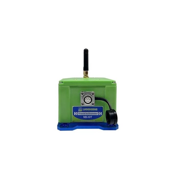
BWSENSING Dual Axis Wireless NB-Iot Inclinometer (NB-WM410)
In stock
- BRAND:
- BWSENSING
- PART #:
- NB-WM410
- ORIGIN:
- China
- AVAILABILITY:
- SUBJECT TO AVAILABILITY
- SKU:
- BWSENSING-NB-WM410
BWSENSING Dual Axis Wireless NB-Iot Inclinometer (NB-WM410)
A tilt sensor is only useful if its reading reaches someone who can act on it. On a slope, a tower base or a retaining wall far from the road, that last step is usually the expensive one. The BWSENSING Dual Axis Wireless NB-Iot Inclinometer (NB-WM410) is built around that step, pairing a high-accuracy tilt sensor with cellular reporting and solar charging so the site does not depend on a cable run.
This product is available through this page, by quotation.
Background
The company and its lineage
The NB-WM410 is made by Bewis Sensing Technology LLC, an innovative and fast-growing company established in 2010. It was born in the Institute of Microelectronics (IME) of Peking University, which places its roots in microelectronics research rather than in general electrical trading. From 2019, BWSENSING has been the approved global brand of the company, and it is the name you will see on the whole range of inclinometers and related sensing products.
For buyers in the Caribbean, that lineage matters in a practical way. Monitoring equipment stays in the field for a long time, and a supplier with a research background and a single global brand is easier to evaluate than a trader with many labels. You can browse the wider family in our BWSensing category, or see related products under Sensors.
Positioning and key technology
The NB-WM410/WS2000 series is a high-accuracy wireless tilt sensor that supports two network modes: NB-IoT and GSM. The NB-WM410 is the dual axis version in that series. Dual axis means it reports inclination in two directions, so one unit can follow how a structure leans in more than one plane. The series also names the NB-WS2000, and any figure on this page belongs to the NB-WM410 only.
NB-IoT is a narrowband cellular technology designed for small, infrequent messages from remote devices. Instead of moving large files, a sensor of this kind sends compact readings, which suits long-term monitoring where the trend matters more than any single sample. The NB-WM410 adds 2G-GSM as a second network option, and it works with a customizable monitoring cloud system for viewing the data it sends.
Technical Specifications
| Specification | NB-WM410 |
|---|---|
| Type | Dual axis wireless NB-IoT inclinometer |
| Accuracy | 0.01° |
| Resolution | 0.0007° |
| Charging | Solar charging |
| Network | NB-IoT and 2G-GSM |
| Max transmission distance | No limit |
| Cloud system | Customizable Monitoring Cloud System |
Specifications as published by the manufacturer; confirmed against the datasheet at quotation.
The manufacturer has not published the measuring range, the dimensions, the weight, the IP rating, the operating temperature, the battery capacity, the power supply, the package contents, the output frequency or the zero temperature drift; they are confirmed at quotation.
What makes the NB-WM410 different from a cabled inclinometer?
A cabled inclinometer gives you a signal at the end of a wire. Someone then has to bring that signal to a logger, power the logger, and keep the whole chain working. On a short run across a building site, that is fine. On a hillside, a long embankment or a tower in open country, the cable, the logger and the power supply can become the larger part of the project.
The NB-WM410 changes the shape of that job. It reports over NB-IoT, with 2G-GSM as a second mode, and it charges from the sun. Its maximum transmission distance is no limit, so the sensor is not tied to a local receiver within radio range. What it needs is coverage from a supported cellular network at the point of installation, and that is worth checking on the ground before you commit to a site.
The measurement figures are the other half of the argument. An accuracy of 0.01° and a resolution of 0.0007° describe a sensor aimed at small changes over time, which is the usual signature of settlement, creep or slow deformation. A coarse tilt switch can tell you that something has fallen over. A sensor with these figures is meant to tell you that something has started to lean.
If your project already has a wired data system and you need a simple digital output, other models in the range may suit you better. The BWSENSING Cost-Effective Dual-Axis Inclinometer (BWM427) and the BWSENSING Cost-Effective Digital Dual-Axis Inclinometer (BWM466) are dual axis alternatives listed on this site, and we can compare them with the NB-WM410 for your application when you ask for a quotation.
Why do NB-IoT and 2G-GSM matter for remote monitoring?
Coverage in island and coastal regions is uneven, and it changes from one operator to the next. A sensor that speaks only one network type can be a poor fit where the signal is thin. The NB-WM410 supports NB-IoT and 2G-GSM, so it has two ways to reach the network, which gives the installer more room when planning a site.
NB-IoT is designed for low data rates, which is exactly what a tilt sensor produces. It does not stream video or large files; it sends a few values at set intervals. That small payload is why the technology is used for remote sensors that must run unattended. Pair that with solar charging and the unit can be mounted where nobody wants to return every week to change a battery or reconnect a cable.
The customizable monitoring cloud system completes the picture. Readings are only useful if they land somewhere an engineer can see trends, set alerts and share results with a client. The cloud system is customizable, and we go through what it should show for your project when you request a quotation.
Who is the NB-WM410 for?
The first group is geotechnical and civil engineers who watch slopes, cuttings, embankments and retaining walls. They need a long record of small angular changes, often at locations without mains power. A solar-charged, cellular-reporting sensor fits that need directly.
The second group is structural monitoring teams responsible for bridges, towers, masts and building foundations. For them, two axes help describe how a structure moves, and wireless reporting avoids drilling through finished surfaces to run cable. Utility operators and telecom tower owners fall into a similar category, because their assets are spread across wide areas and visited rarely.
Consultants and integrators are a third group. If you build monitoring systems for clients, a sensor with its own network connection and a customizable cloud platform can shorten the path from installation to a working dashboard. On the other hand, if your site already has a wired data acquisition system and a single tilt direction is enough, a simpler digital model such as the BWSENSING Cost-Effective Single-Axis CAN Output Inclinometer (BWM415) may be the better fit.
What is the NB-WM410 used for?
- Slope and landslide monitoring. Track slow lean on hillsides and cuttings where rainfall and soil movement are a concern.
- Retaining wall observation. Follow the tilt of a wall over months to see whether it is moving outward.
- Bridge and tower monitoring. Record inclination on piers, masts and towers without running cable to the structure.
- Foundation settlement checks. Watch buildings and foundations during and after construction for uneven settling.
- Remote asset surveillance. Keep an eye on structures in places that are costly or slow to visit.
- Cloud-based reporting. Send readings to the monitoring cloud system so teams can review trends from any location.
Pricing and Availability
We do not print prices on this page. Quotation is the way to buy: tell us the number of units, the site and the network you expect to use, and we will respond with a proposal. Delivery, customs and support are arranged with the quotation, so you see the whole picture before you order. The NB-WM410 is available on this page.
Frequently Asked Questions
What does the NB-WM410 measure?
It measures inclination on two axes, with an accuracy of 0.01° and a resolution of 0.0007°.
How does it send its data?
It works over NB-IoT and 2G-GSM. The readings go to a customizable monitoring cloud system.
How is the sensor powered?
It charges from the sun through solar charging, which suits sites without mains power.
Is there a limit on transmission distance?
The maximum transmission distance is no limit. The sensor still needs network coverage at the installation point.
What is the difference between the NB-WM410 and the NB-WS2000?
Both belong to the same series, a high-accuracy wireless tilt sensor with NB-IoT and GSM modes. The NB-WM410 is the dual axis version, and its figures are not assigned to any other model.
Does it need cabling to a data logger?
No. It reports over cellular networks to the cloud system, so a cable run to a local logger is not part of the setup.
Where can I buy the NB-WM410 and what does it cost?
You can buy it through this page by requesting a quotation. Pricing is given in the quotation, together with delivery, customs and support arrangements.
Summary
The hard part of remote tilt monitoring is rarely the sensor itself; it is power, cabling and getting the reading home. The NB-WM410 answers that with two axes of measurement, 0.01° accuracy, 0.0007° resolution, solar charging, NB-IoT and 2G-GSM networks and a customizable monitoring cloud system. If a slope, a wall, a tower or a foundation in your region needs watching from a distance, this page is the starting point.